Digital Media Center
Bryant-Denny Stadium, Gate 61
920 Paul Bryant Drive
Tuscaloosa, AL 35487-0370
(800) 654-4262

© 2024 Alabama Public Radio
Play Live Radio
Next Up:
0:00
0:00
0:00 0:00
Available On Air Stations

LOOK: Map Of Mars' Gravity Illuminates Planet's Interior

A Martian gravity map shows the Tharsis volcanoes and surrounding flexure. The white areas in the center are higher-gravity regions produced by the massive Tharsis volcanoes, and the surrounding blue areas are lower-gravity regions that may be cracks in the crust (lithosphere).
MIT/UMBC-CRESST/GSFC via NASA
A Martian gravity map shows the Tharsis volcanoes and surrounding flexure. The white areas in the center are higher-gravity regions produced by the massive Tharsis volcanoes, and the surrounding blue areas are lower-gravity regions that may be cracks in the crust (lithosphere).

NASA has released a new gravity map of Mars, providing a detailed look at the Red Planet's surface and revealing new information about what lies beneath it.

The map was made by tracking subtle variations in the planet's gravitational pull on orbiting spacecraft. As NASA explains: "The pull will be a bit stronger over a mountain, and slightly weaker over a canyon."

Using this technology, it's possible to look inside a planet "just as a doctor uses an X-ray to see inside a patient," Antonio Genova of the Massachusetts Institute of Technology, who was lead author of a paper on Mars' gravity, said in a NASA press release.

And the NASA release says this improved view confirms that "Mars has a liquid outer core of molten rock." The researchers determined this by "analyzing tides in the Martian crust and mantle caused by the gravitational pull of the sun and the two moons over Mars."
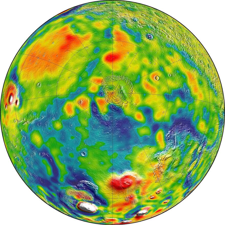
A map of Martian gravity looking down on the North Pole (center). White and red are areas of higher gravity; blue indicates areas of lower gravity.
/ MIT/UMBC-CRESST/GSFC via NASA
/
MIT/UMBC-CRESST/GSFC via NASA
A map of Martian gravity looking down on the North Pole (center). White and red are areas of higher gravity; blue indicates areas of lower gravity.

The map also provides new details about the Red Planet's ice caps. NASA says it was able to use data from the Mars Reconnaissance Orbiter to determine "that when one hemisphere experiences winter, approximately 3 to 4 trillion tons of carbon dioxide freezes out of the atmosphere onto the northern and southern polar caps, respectively."

Scientists say the more detailed knowledge of Mars' surface and gravitational dynamics will also assist in future missions to the planet's orbit.

Copyright 2021 NPR. To see more, visit https://www.npr.org.
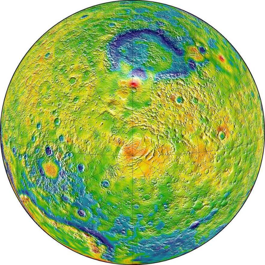
A map of Martian gravity looking down at the South Pole (center).
/ MIT/UMBC-CRESST/GSFC via NASA
/
MIT/UMBC-CRESST/GSFC via NASA
A map of Martian gravity looking down at the South Pole (center).

Merrit Kennedy is a reporter for NPR's News Desk. She covers a broad range of issues, from the latest developments out of the Middle East to science research news.
News from Alabama Public Radio is a public service in association with the University of Alabama. We depend on your help to keep our programming on the air and online. Please consider supporting the news you rely on with a donation today. Every contribution, no matter the size, propels our vital coverage. Thank you.