-
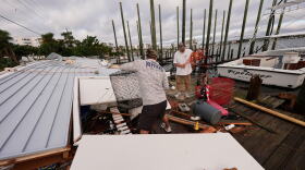 Published reports say that heavy winds from Hurricane Isaias led to two fatalities in Alabama and Florida (updated to four.) NBC news reports that one person was killed in East Birmingham when a tree fell on a house. Another person was trapped. CBS News reports a woman in Escambia County, Florida died when a tree hit her house in the winds of Isaias. The other two fatalities also resulted from trees hitting homes.
 -
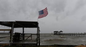 Hundreds of thousands of people in Alabama and the Florida Panhandle were without power early Saturday after Isaias crashed into the U.S. Gulf Coast as a dangerous hurricane and left flooded roads and downed trees in its wake as it moved inland. Poweroutage.us reports 300,000 in Alabama in the dark this morning, and 400,000 more in Florida.
 -
 The rules for tomorrow’s high stakes Southeastern Conference game between The Crimson Tide and the Bulldogs are changing. Partly due to the possible attendance of President Trump, and due to the impending arrival of Hurricane Isaias. College football games in Tuscaloosa typically see white tents blossoming on a green space at the University of Alabama known as the “quad.” That’s where tailgaters gather to party before kickoff.
 -
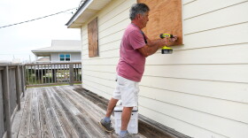
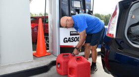 Residents boarded up windows and stacked sandbags Thursday while thousands of National Guard soldiers were deploying in anticipation of Hurricane Isaias, which packed swift winds and threatened to bring a storm surge with devastating floods to the U.S. Gulf Coast.
 -
 Isaias strengthened into a Category 2 hurricane as it barreled toward a possible landfall on Alabama’s border with Florida. The approach of the storm is prompting orders for tourists to abandon beaches for safer spots inland, sending locals scurrying for gas and groceries and leading fishing crews to secure their boats before the potentially destructive storm’s arrival.
 -
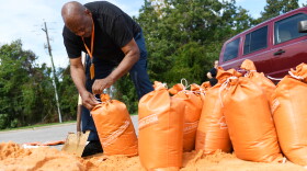 Residents of Alabama, coastal Mississippi, and the western Florida panhandle are getting ready for rough ride from Hurricane Isaias. Forecasters are predicting landfall late Friday or early Saturday. That hit could occur anywhere from Ocean Springs in Mississippi, to Mobile and the Eastern Shore in Alabama, to the western Florida panhandle. The lower third of our state is facing the possibility of tropical storm force winds and rain. Mike Evans is manager of Mobile County Emergency Management. He says residents need to get storm updates from a trusted source like the National Weather Service.
 -
 Some coastal residents of Alabama are being advised to voluntarily evacuate as Isaias surged toward the U.S. Gulf Coast on Thursday. It’s the first hurricane of the Atlantic season, prompting mandatory evacuations and school closures in parts of Florida. Isaias was forecast to intensify rapidly and bring strong winds and a life-threatening storm surge to the Florida Panhandle, southern Alabama and southern Mississippi when it makes landfall on the northern Gulf Coast late Friday or early Saturday. Heavy rain with the risk of flooding was possible into the weekend as far inland as the Tennessee Valley.
 -
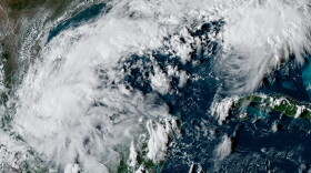 Hurricane forecasters are keeping an eye on the progress of Isaias. The system grew to tropical storm strength on Wednesday, and is expected to be a hurricane when it reaches anywhere form Gulfport in Mississippi, to Mobile, to Panama City Beach in Florida. The latest forecast has landfall expected sometime Friday Night. Before Isaias formed, APR student reporter John Underwood talked with three experts for tips on how to get ready for this year’s hurricane season. One special note—John’s story talks about preparing for evacuation.EDITOR'S Note— Local leaders in Gulf Shores and Orange Beach in Alabama are advising residents of low lying areas to voluntarily evacuate. In Florida, the Associated Press is reporting that some residents of RV parks in Gulf County and Okaloosa County (Zones A and B) are under a mandatory evacuation order.
 -
 Tropical Storm Isaias has formed off eastern Mexico. Forecasters say it is expected to strengthen into a hurricane and hit the U.S. Gulf Coast later in the week. Early Wednesday morning, Isaias was located about 285 miles west of Progreso, Mexico, and about 580 miles southwest of the Mississippi River’s mouth.
 -
 As forecasters with the National Hurricane Center watch the progress of Hurricane Erin, weather watchers say the most powerful storms tend to form later in the year.

Digital Media Center
Bryant-Denny Stadium, Gate 4
Box 870370
920 Paul Bryant Drive
Tuscaloosa, AL 35487-0370
205-348-6644
© 2026 Alabama Public Radio
Bryant-Denny Stadium, Gate 4
Box 870370
920 Paul Bryant Drive
Tuscaloosa, AL 35487-0370
205-348-6644
© 2026 Alabama Public Radio
Play Live Radio
Next Up:
0:00
0:00
Available On Air Stations


