Updated 11:30 a.m. ET
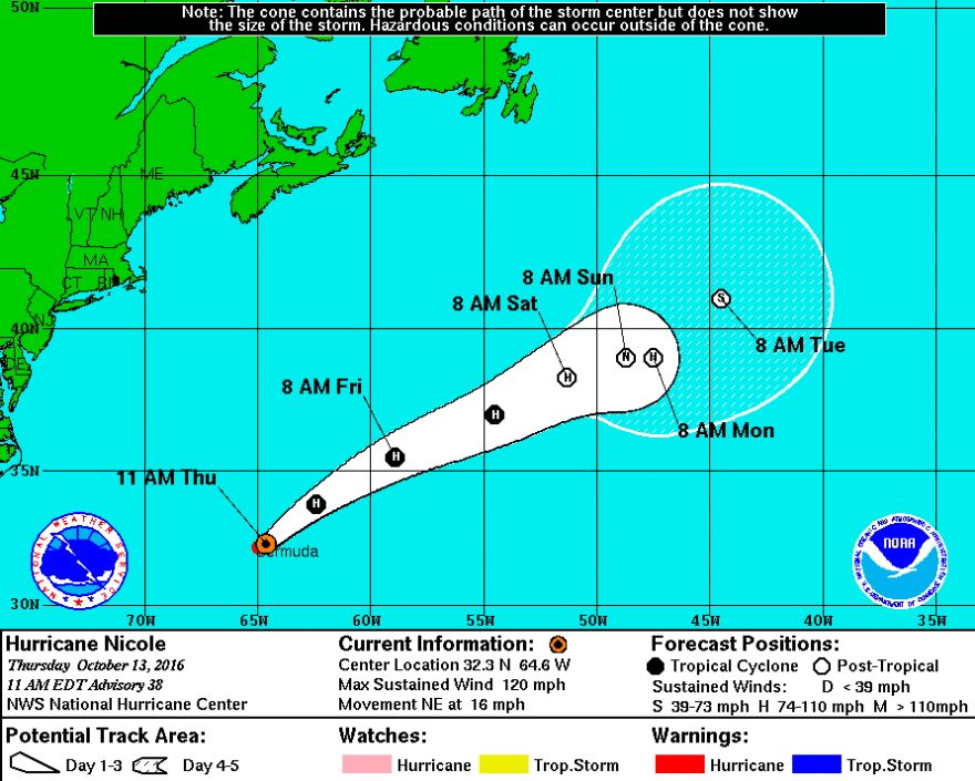
People in Bermuda were bracing themselves as Hurricane Nicole, a Category 3 storm, hit the island Thursday. The eye passed over the island nation around 11 a.m. local time.
The National Hurricane Center called the storm "extremely dangerous," with maximum sustained winds of 125 mph and a wide path that whips everything within 65 miles of its center with hurricane force winds.

"A dangerous storm surge will raise water levels by as much as 6 to 8 feet above normal tide levels in Bermuda. The surge will be accompanied by large and destructive waves," a National Hurricane Center advisory said on Thursday morning. "[Hurricane] Nicole is expected to produce total rain accumulations of 5 to 8 inches over Bermuda through this evening."
Isolated tornadoes are also possible in Bermuda on Thursday.
The path of Hurricane Nicole, just a week after its sibling-storm Hurricane Matthew killed hundreds of people in the Caribbean and dozens in U.S., is expected to take the storm away from the U.S. East Coast. But even as its trajectory sends it safely northeast into the Atlantic, it likely will create dangerous swell conditions along the battered North Carolina and South Carolina coasts.
Over the next few days, the National Hurricane Center warns people "from the Carolinas northward" to be careful of ocean rip currents.
In Bermuda on Thursday, schools and government offices were closed, reports The Associated Press. James Dodgson, deputy director at the Bermuda Weather Service, told the wire service he had been hoping the storm would hit the country dead-on, rather than skirting the island.
"We were hopeful that it would come across so we could at least get a break," he told the AP, referring to the comparative lull when the eye of a hurricane passes over.
Copyright 2021 NPR. To see more, visit https://www.npr.org.


